The Britain Nobody Knows

A site of Caddo Publications USA

Historical Cities-Inverness, Scotland, UK (Google Maps)

Our historical guide to Inverness is now available for exploring on Google Maps.  Over 90 historical landmarks and sites are provided for your education and entertainment.

Visit our website, autotrails.net, for this free guide and many others.


Historical Cities-Great Yarmouth, England, U.K.

Explore the historical sites and landmarks of the city of Great Yarmouth using our guide in Google Maps.  Over 50 historical points of interest are identified with text providing background information.  This a link to the guide is available on our Auto Trails website.

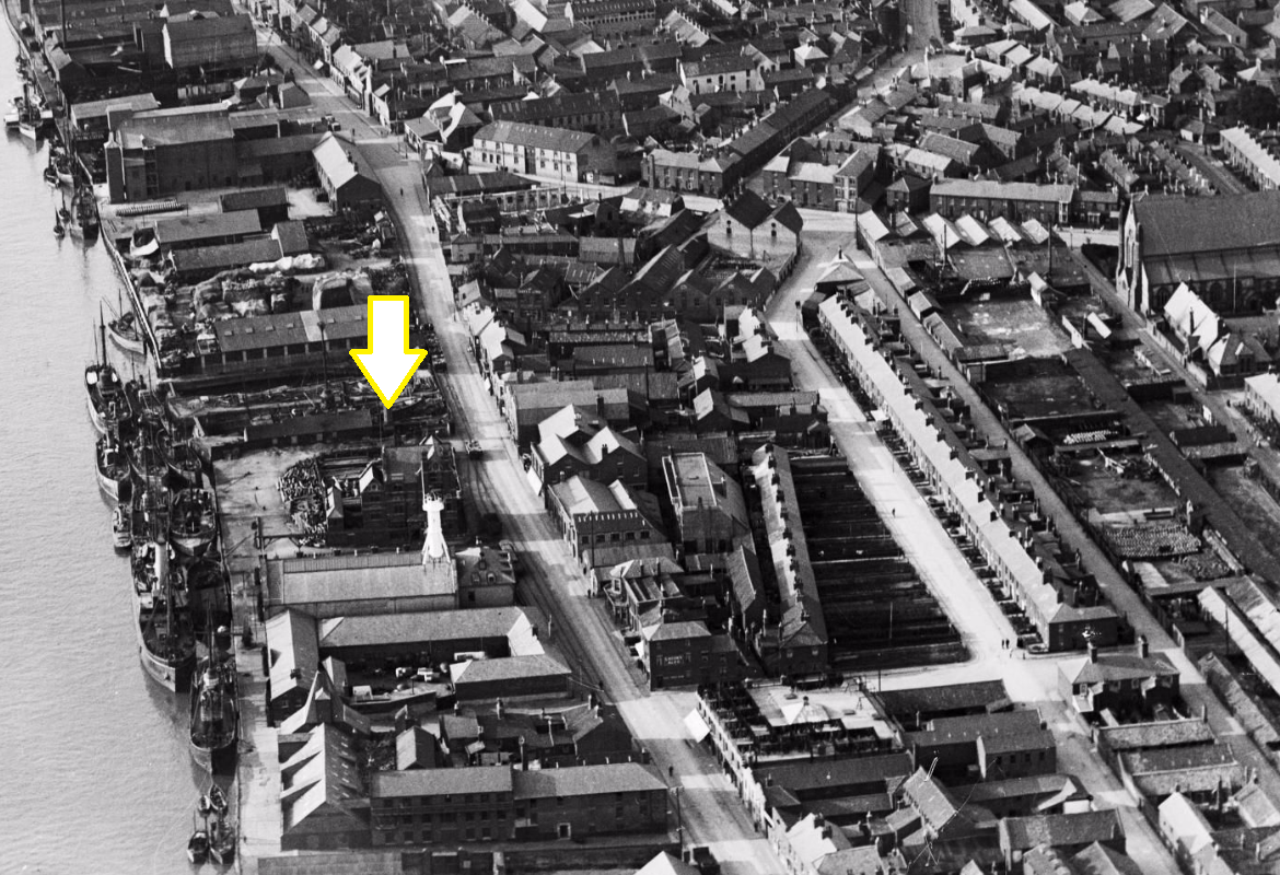
Britain Nobody Knows-Site of Walrond Smack Boys’ Home, Great Yarmouth (16 Southgates Road)

Site of Walrond Memorial Smack Boys’ Home  (16 Southgates Road, Great Yarmouth)

The Smack Boys’ Home and Fishermen’s Institute, on the Ballast quay, was erected in 1875, the chief object of which was to provide proper accommodation when ashore for the neglected class of smack boys. These boys served on fishing vessels that had a well to preserve the catch.  These vessels were called smacks.

The buildings were of a Gothic character, freely treated, and contained office, dining room, reading-room, large room for meetings, dormitories on the separate bunk system, rooms for the manager and the necessary offices.  The following is from an article The Sunday Magazine, published in 1879:

“On the groundfloor I find two good-sized rooms, in the larger of which some smack boys, looking very much at home, are chatting or playing at bagatelle. Above this is a fishermen’s reading-room, and on the same floor a small dormitory with five beds, the gift of the “Waterside Mission,” or rather of some ladies connected with it. At the top of the house, running the whole length of the building, is the large sleeping place, divided into little cabins, with a bed and locker in each, and there is another set of beds resting on the wooden ceilings of these “cubicles,” as they are called. These strike one at first sight as making the room unnecessarily close; but I suppose from their name they contain the right amount of cubic air, and fish-boys’ ordinary sea-quarters are the reverse of lofty. At any rate, the smack boys well appreciate the advantages of their Home, as, in the two years it has been open, three hundred and nineteen lads have lodged here. Seventy is about the number of the regular inmates.”

It stood from 1875 until 18 February 1941 when it received a direct hit and was destroyed in a Luftwaffe bombing raid which took place between the hours of 0300 and 0544. That same night shrapnel from a German High Explosive bomb punctured and ignited the Gas Holder on Admiralty Road, which lit up the skies.  Until the Civil Defence and Fire Brigade cooled down and extinguished the blaze it was a marker for the other German bombers. Twenty-eight High Explosive bombs and 100 Incendiary Bombs hit Great Yarmouth that night, 6 falling on the Quayside, 1 hitting and destroying this building.[i]
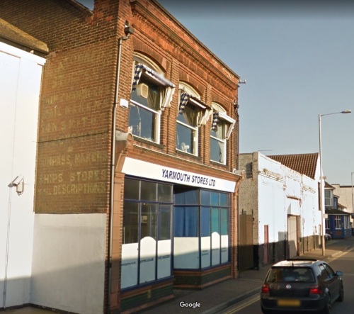
Vintage advertisement on wall of building across from site.

[i] epw001876 ENGLAND (1920), South Quay, Great Yarmouth, 1920 (www.britainfromabove.org.uk)

Britain Nobody Knows-Barrack Road Gasometer, Great Yarmouth

Barrack Road Gasometer (Admiralty Road, between Barrack Road and Sutton Road)

This gasometer was built at another location, but after it collapsed it was rebuilt here in 1885.

Gasometers appeared on the British urban landscape in the first half of the 19th century to store the gas produced in adjacent gasworks. In 1824, the first floating or telescopic gas holder was built in Leeds. It used an external circular frame supported by columns of a fixed height which allowed the enclosed container to rise and fall on a floating water reservoir. As gas from coal was pumped in, the giant domed container would silently rise inside the cylindrical steel frame.[i]

[i] The Guardian (https://www.theguardian.com/artanddesign/2015/jun/14/gasometers-gas-holders-hold-on-for-a-new-life-repurposing)


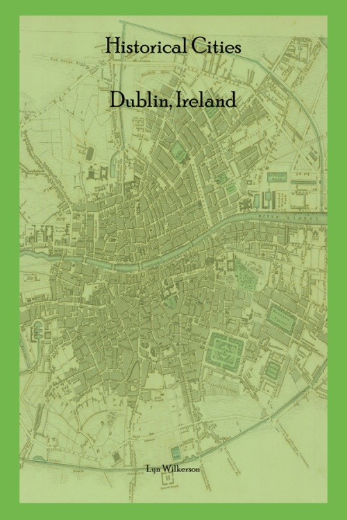
Historical Cities-Dublin, Ireland is now available on Google Maps

Links to Google Map and Companion Text

Historical Cities-Dublin, Ireland provides information about the historic sites and landmarks within the city centre of Dublin and in the surrounding vicinity.  It is not our desire to dramatize the history or expand on it in any way.  We believe that the character and culture of the city can speak for itself.  The guide has been created, not for just travelers new to the city, but for current residents who may not realize what lies just around the corner in their own neighborhood.  This is not intended to be an exhaustive guide to all sites, as the individual traveler will find their own historical treasures amongst the landmarks we present.

HC-Inverness Cover

London Nobody Knows-Now Available on Google Maps

London Nobody Knows provides a listing of 173 historic sites around the city of London.  Most of these sites are ones that are often overlooked by the typical tourist to the city.

Our website below contains a link to the Google Maps page, as well as a link to our guidebook for the sites provided.

https://www.autotrails.net/map-guides/

Historical Cities-Dublin, Ireland will be available 5/29/2013

Our latest guide, Historical Cities-Dublin, Ireland, will be available on 5/29/2013 in the Amazon Kindle store.  We hope to have it available by the first week of June in the iBookstore and Barnes & Noble Nook.  Over 100 historical sites and landmarks in Dublin’s city centre and surrounding environs are explored, from the more popular to the mostly obscure.  Reference maps and GPS coordinates are available, as well as an historical excerpt and maps from guides written for the city in the 19th century.


Forgotten Landmark-Stone Tenter House, Brickfield Lane, Dublin

Stove Tenter House

Stove Tenter House (Brickfield Lane, between Cork Street and Brown Street South, Dublin, Ireland)

What one great and good man can effect, towards ameliorating the condition of his fellow creatures, is strikingly proved by the following sketch of the Stove Tenter House, erected by Thomas Pleasants, Esq. in 1815, for £12,964. In the space of twelve months, 1018 pieces of cloth were tentered, 1588 chains or warps were sized and dried, and 1450 stones of wool were dyed, beneath the shelter of this truly charitable asylum.

Before the erection of this building, the poor weavers in the liberty were wholly destitute of employment in rainy weather, or else endeavored to tenter their cloths before the ale-house fire; and hence exposed to great distress, and not infrequently reduced either to the hospital or the gaol.  After the building of the Tenter House, during the season of extreme and general distress, in 1816, not one woolen weaver was found imploring relief, or within the walls of a prison; need we wonder then at the extravagant blessings and prayers bestowed by thirty thousand persons on one of the noblest characters, in point of pure benevolence and patriotism, that ever adorned this country. The stranger will learn with gladness that Mr. Pleasants lived to witness the matured success of this truly-benevolent design.

The building, which is situated between Cork and Brown streets, a little to the east of the Fever Hospital, is a brick edifice 275 feet in length, and three stories high.[i]


[i] Historical Guide to the City of Dublin; G.N. Wright, 1825; pg. 187-188.

Forgotten Landmark-Green Street Courthouse, Green Street at St. Michan’s Park, Dublin, Ireland

Green Street Courthouse (Green Street next to St. Michan’s Park)

Green Street Courthouse is home to the Irish Special Criminal Court which deals with high security cases involving terrorism or organised crime. The courthouse was designed by Whitmore Davis and constructed in 1797. It also has a façade on Halston Street.  The structure was the scene of many trials including those of Wolfe Tone, Robert Emmet and other Fenian leaders. Lord Edward Fitzgerald died here from the injuries incurred during his arrest by Major Sirr.  The stone cylindrical volume to the right of the Green Street façade is all that remains of the old Newgate Gaol which was on this site. The public park covers the remainder of the prison’s foundation.[i]


[i] 1797 – Green Street Courthouse, Dublin; Archiseek, http://archiseek.com/2010/1797-green-street-courthouse-dublin/

Green Street Courthouse

Forgotten Landmark-Pleasants’ Asylum, 75 Camden Street Lower, Dublin, Ireland

Pleasant's Asylum

Site of Pleasants’ Asylum (75 Camden Street Lower)

The charitable Mr. Pleasants bequeathed £15,000 for the purpose of establishing a female Orphan House for the daughters of respectable house holders. This asylum, which was situated on the west side of Camden Street, was opened in 1818 for twenty female orphans, solely Protestants, who were clothed, educated and maintained in a manner exceeding anything of a similar description in the British empire. When they arrived at mature age, they received a handsome portion, should they find suitable partner.[i]


[i] History of Ancient and Modern Dublin; or Visitor’s Guide to the Metropolis of Ireland; M. Starrat; Dublin, J. Charles 57 Mary Street, 1830; pg. 117.


Design a site like this with WordPress.com
Get started